Cutting Edge Drone Technology
Drone Progress Mapping Services
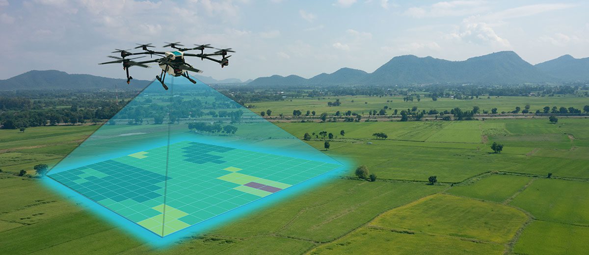
When you need to map a vast geographical area, drone mapping can gather the data you need quickly and accurately. This is a cost-effective solution that captures the dimensions needed for a range of uses such as agriculture, forestry, government, and general cartography.
Commercial Applications
Progress mapping is critical to ensure commercial projects stay on time and in budget. Drones can track construction progress with safe, cost-effective aerial videos, time-lapse footage and imagery that provides developers with all the
data needed to monitor construction projects.
Highlight Milestones
Video Footage for Client Meetings
Time Lapse Videos for Social Media
Before and After Images
Public Sector Applications
Large-scale projects such as highway maintenance must be monitored so that councils can keep track of expenditure and impact on the local community. Drone data helps to maintain project timelines, meet contracts plus health and safety goals.
Health and Safety Monitoring
Local Government Data Source
Highway Maintenance Progress Tracking
GPS Referencing
Useful Information
